Google My Maps is a map creation and publishing tool integrated into Google Drive. Users can create, share, publish, and collaborate on custom maps, as well as save maps in their Google Drive as they would any other type of Google Doc.
The mapping tool allows students or teachers to:
- Create custom placemarks at any location in the world
- Associate web links, images, and other information with any placemark created on the map
- Draw lines and shapes that automatically measure distance and calculate area
- Import spreadsheets of geographic data (place names, addresses, or latitude-longitude coordinates) to instantly populate a map with placemarks and additional data
- Add multiple layers of information that can each be separately styled and toggled on or off
- Choose from various base map views, including terrain, satellite, city roads, and political
- Keep a map private, or collaborate on a map with others in real time, as with other types of Google Docs
- Embed custom maps on a web page, share via a permanent link, print, or export as a KML file
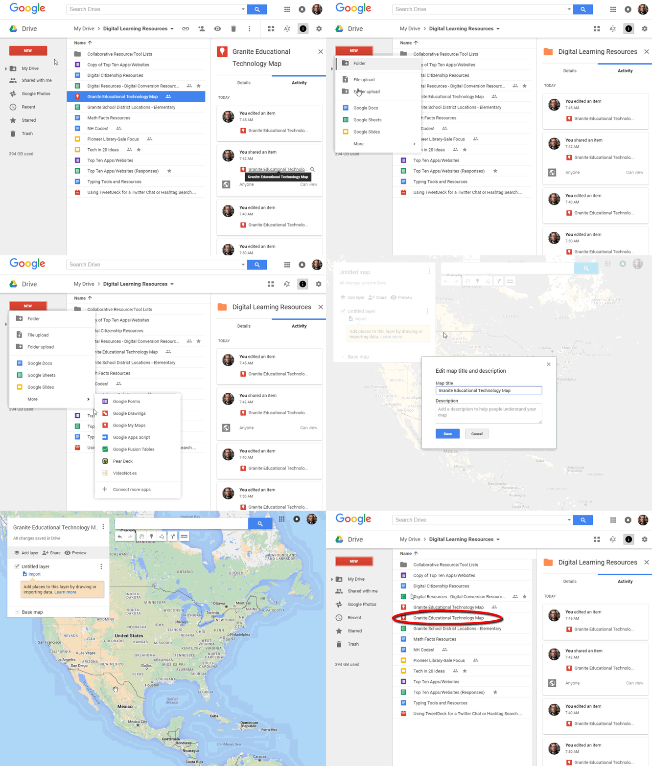
Creating a new map is as easy as clicking on the NEW button in Google Drive, then More, and choosing Google My Maps.

You can also manage your maps outside of Google Drive by visiting https://www.google.com/maps/d/.
Additional Resources
My Maps is a powerful geography tool, but teachers have also applied it across the curriculum, using it with their students for learning activities in content areas from English Language Arts to Math. It also has many fun applications for personal and family projects. For more help and information on Google My Maps in the classroom, try these resources and ideas:
- 20 ways Google My Maps can enhance lessons in any class | Ditch That Textbook
- 10 Reasons to Use Google My Maps in the Classroom | Edutopia
- 10 Ways to Use Google Maps in the Classroom | The Thinking Stick
- My Maps Help | Google Support
- Create, share, and manage custom maps from Drive | Google for Education Blog

You must be logged in to post a comment.